Places Member List Viewing profile
Selati Game Reserve
Conservation Area
Game Reserve
10km from Gravelotte, Limpopo Province, South Africa
-24.00791817874, 30.6841641227
Conservation Area
Game Reserve
10km from Gravelotte, Limpopo Province, South Africa
-24.00791817874, 30.6841641227
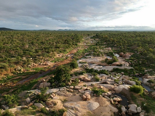
The Selati Game Reserve falls within the UNESCO declared Kruger 2 Canyon Biosphere. The 28,000 ha private reserve has a rich and diverse geological history. The Murchison Greenstone belt in the north-west of the reserve contains the oldest rock formations on earth while most of the remainder of the reserve is made up of three different granite and pegmatite formations; the Willie, Lekkersmaak and Mashishimale granite/gneiss. The most spectacular of these is the Mashishimale granite in the south which includes the Lillie koppies/hills and provides the sole habitat on the planet for the rare cycad, Encephalartos dyerianus.
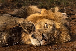
It is home to the big five, as well as herds of Sable and Eland. The reserve is also working with the Endangered Wildlife Trust (EWT) on a cheetah relocation project and Vulture Safe Zones Project, as well as WWF on their Black Rhino Range Expansion Project. Over 300 bird species have been identified on the reserve including various endangered vulture species, and a nesting pair of endangered Martial Eagles.
The reserve is considered a wilderness area, with a low ecological footprint. The reserve does extensive fundraising for various conservation and community projects through the Selati Wilderness Foundation: www.selatiwf.org.
Conservation & Community Highlights:
- Volunteer programme
- Lilly Cycad nursery
- Community Outreach – teaching local children about conservation
- Cheetah relocation to the reserve
- Black Rhino monitoring
Future Aims:
- Research and digital marketing volunteer programme growth
- Counter-Poaching Unit enhancement (night vision goggles, binoculars, vehicles, camping equipment, fuel, boots, etc.)
- Enhancing the Lilly Cycad nursery
- Funding for community environmental education programmes and school upgrade
- Technology (tracking tags, collars, camera traps, ArcGIS, booster towers, etc.) required to monitor fauna and flora and any movement on the reserve